Weizmann Institute scientists have shown that dry air crossing the equator intensifies the monsoon rains over India. These surprising findings may improve flood warning capabilities and be good news for hundreds of millions
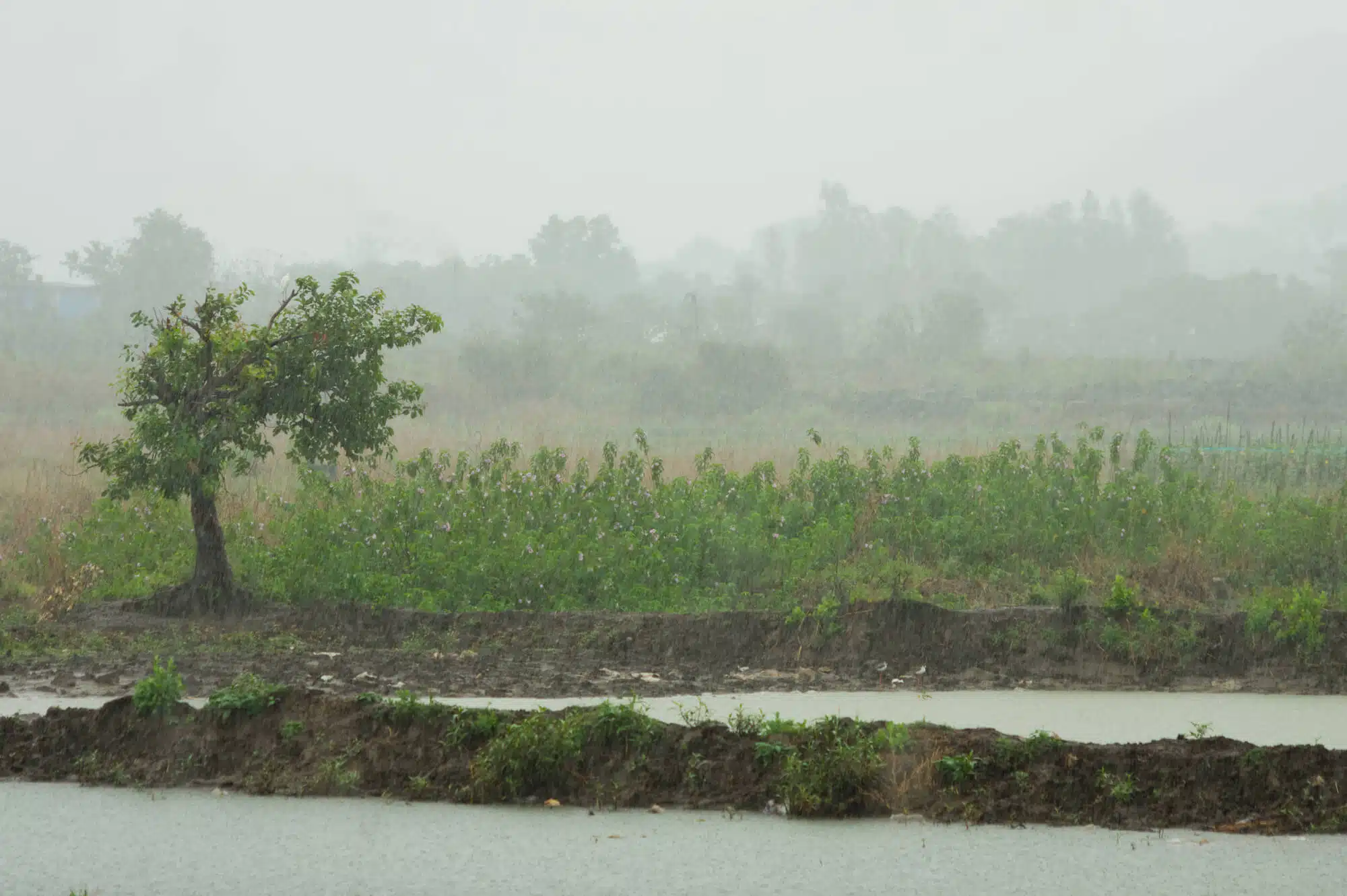
More than 400 people were killed in a series of floods that hit the state of Kerala in southwestern India in 2018 - and millions more lost their homes. While heavy rains and even floods are commonplace during the Asian monsoon, the challenge is to predict when they might turn into unusual and life-threatening floods. Recently, scientists from the Weizmann Institute of Science discovered a surprising factor that affects the intensity of the Indian monsoon rains. Their findings may expand the forecasting window for unusual rain events and thus be good news for the hundreds of millions living in the subcontinent.
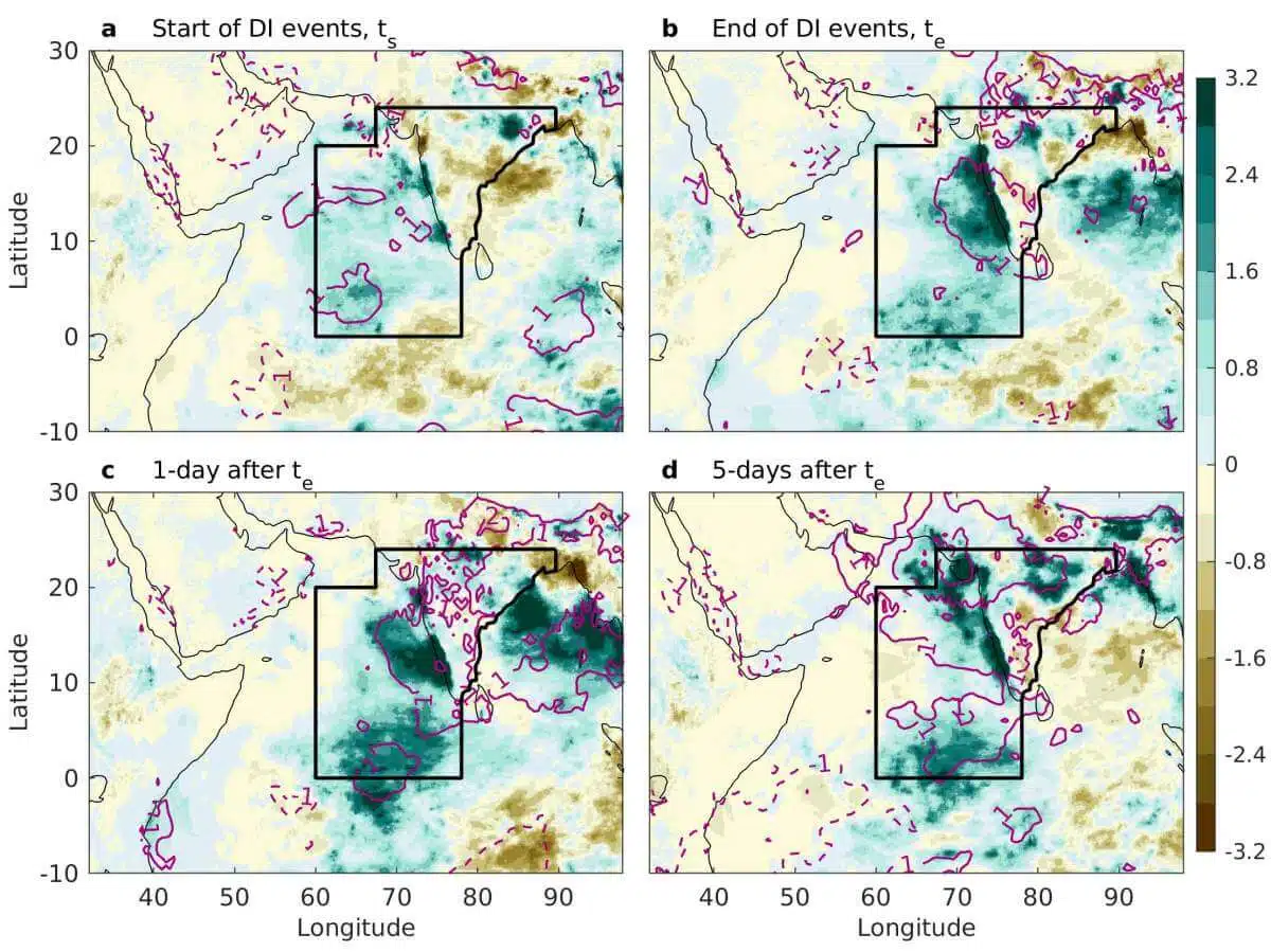
The monsoon rains that fall on the Indian peninsula every year between the months of June and September are a complex phenomenon, which is affected by many different climatic processes. in research recently published, points out dr Shira Rave-Rubin From the Department of Earth and Planetary Sciences of the Institute and a post-doctoral researcher in her laboratory, Dr. Deepika Rai, about a climatic process whose effect on rainfall in the region was not known until now: air currents of a certain type, called "dry air infiltration". As their name suggests, these air currents consist of dry air at low temperatures, especially compared to the moist air of the monsoon rains. Until now, it was assumed, with some justice, that infiltrations of dry air that sink into the lower levels of the troposphere - the lower layer of the atmosphere - lead to "monsoon breaks": short periods of relative dryness during the rainy season. But as the new study demonstrates, it seems that this assumption is not entirely correct.
While dry air intrusions happen in many places around the world, as far as is known today intrusions that cross the equator from south to north occur only in the Indian Ocean region. Dr. Rave-Rubin and Dr. Rai examined these air infiltration data, which spanned 40 years - 137 events between the years 1979 and 2018 - and compared them to precipitation data from the same period. Surprisingly, they discovered that these infiltrations did not lead to dry weather as expected, but rather to an increase in the amount of rainfall - an increase of 17% on average, and in some cases an increase of more than 100%.
"How exactly does dry air cause more rain?" Dr. Rowe-Robin asked. To understand the phenomenon, the two researchers applied a model based on principles of flow mechanics. Within the framework of the model, the researchers adopted a different perspective on the data: they treated the continuous air currents as a collection of discrete "air parcels", and examined how those parcels changed over time. Among other things, the model tracked changes in the location, temperature and water content of each air parcel. Using this tracking, the researchers noticed an increase in humidity that increases as the air current moves from the sea towards the land. According to them, the explanation for this lies in the interaction between the air currents and the ocean water: the dry air currents come into contact with the Indian Ocean water and act in fact like a sponge. The greater the difference between the moisture of the ocean surface and the dry air, the more water that evaporates from the ocean surface can be absorbed by the air. Thus, the current of air is "charged" with water, which it transports to the north, towards the west coast of India.
While previous studies have used similar research methods to try to understand the patterns behind monsoon rains and lulls, until now the impact of these specific intrusions, which cross the equator over the ocean, has not been examined. These intrusions behave differently from their terrestrial counterparts. This is the reason, according to Dr. Rowe-Robin, that until now the assumption was that this phenomenon would bring drier weather in its wake. "This is actually the way in which the winter of the Southern Hemisphere breaks into the summer of the Northern Hemisphere," she says.
When asked why she thinks this mechanism has not been identified until now, Dr. Rave-Rubin points out that most of the climatic mechanisms that influence the behavior of the monsoon occur over longer periods. For example, one of the factors that has the greatest impact on monsoon rain patterns is the change in sea surface temperature, which is the result of processes that last months and years. Dry air intrusions, on the other hand, occur over much shorter periods of time, often a few days. Because climate scientists have focused on studying the longer processes, not enough attention has been paid to processes that take place over much shorter time constants. This is how the scientific community actually "missed" the effect of dry air currents on the monsoon.
For Dr. Rowe-Robin and her research group, the science behind dry air permeability is not so dry. "It's not just an abstract physical theory, but you see it in reality, in the data, and with the eyes outside," she says. The possibility that her research will in the future lead to more accurate warnings about floods in places like India and Bangladesh - places where hundreds of millions live under threat - only strengthens her desire to delve deeper into the subject. She predicts that the ability to monitor dry air permeability - an ability that already exists today - will significantly improve the way we can anticipate unusual rain events. Dr. Rowe-Robin predicts that we will be able to increase the time window for warning about extreme weather events from a day or two today, to a week or more. An earlier warning will make it possible to prepare for floods and even evacuate a population if necessary, thus saving hundreds and even thousands of people.
And what is the prognosis for Dr. Rowe-Robin and her group? Deepening the understanding of dry air permeability and its climatic consequences. Among other things, the group will investigate how and why these air currents are created in the first place, and will examine events of dry air penetration in other parts of the world - in search of similar effects.
More of the topic in Hayadan:
