The desert landscape brings with it an extensive field of research. This time, a research group from Ben-Gurion University of the Negev and the Geological Institute analyzed the shape of the landscape in the popular hiking area and pointed to the model for the development of Nahal Peretzim in its unique form
Nahal Peretz in the southern Dead Sea is known as a famous site for hiking and cycling. The stream that goes underground in the plain of Amiaz and flows into the Dead Sea creates a deep and impressive system of canyons. The processes that created the unique system were studied by a research group from the Department of Earth and Environmental Sciences at Ben-Gurion University of the Negev together with their partners from the Geological Institute.
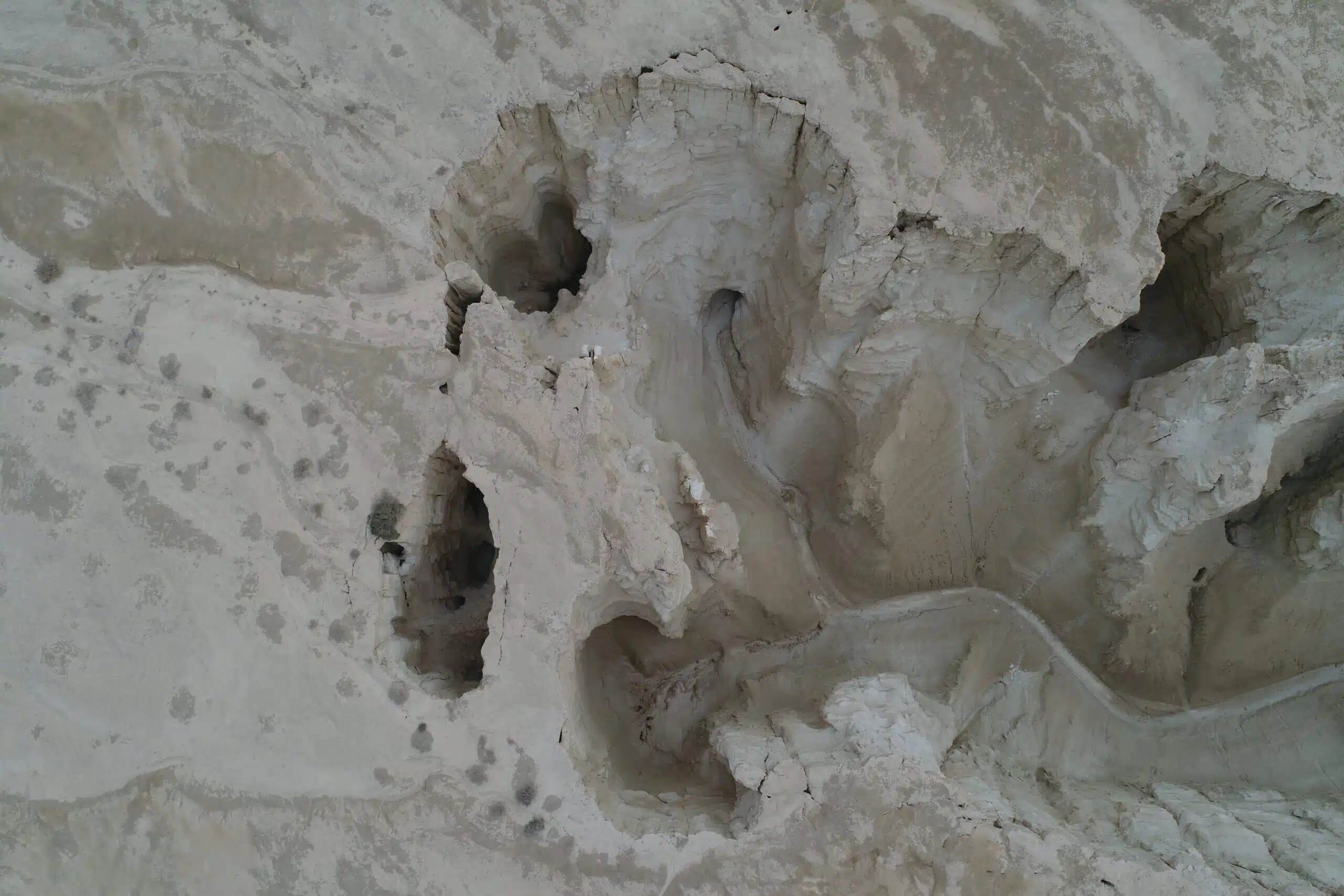
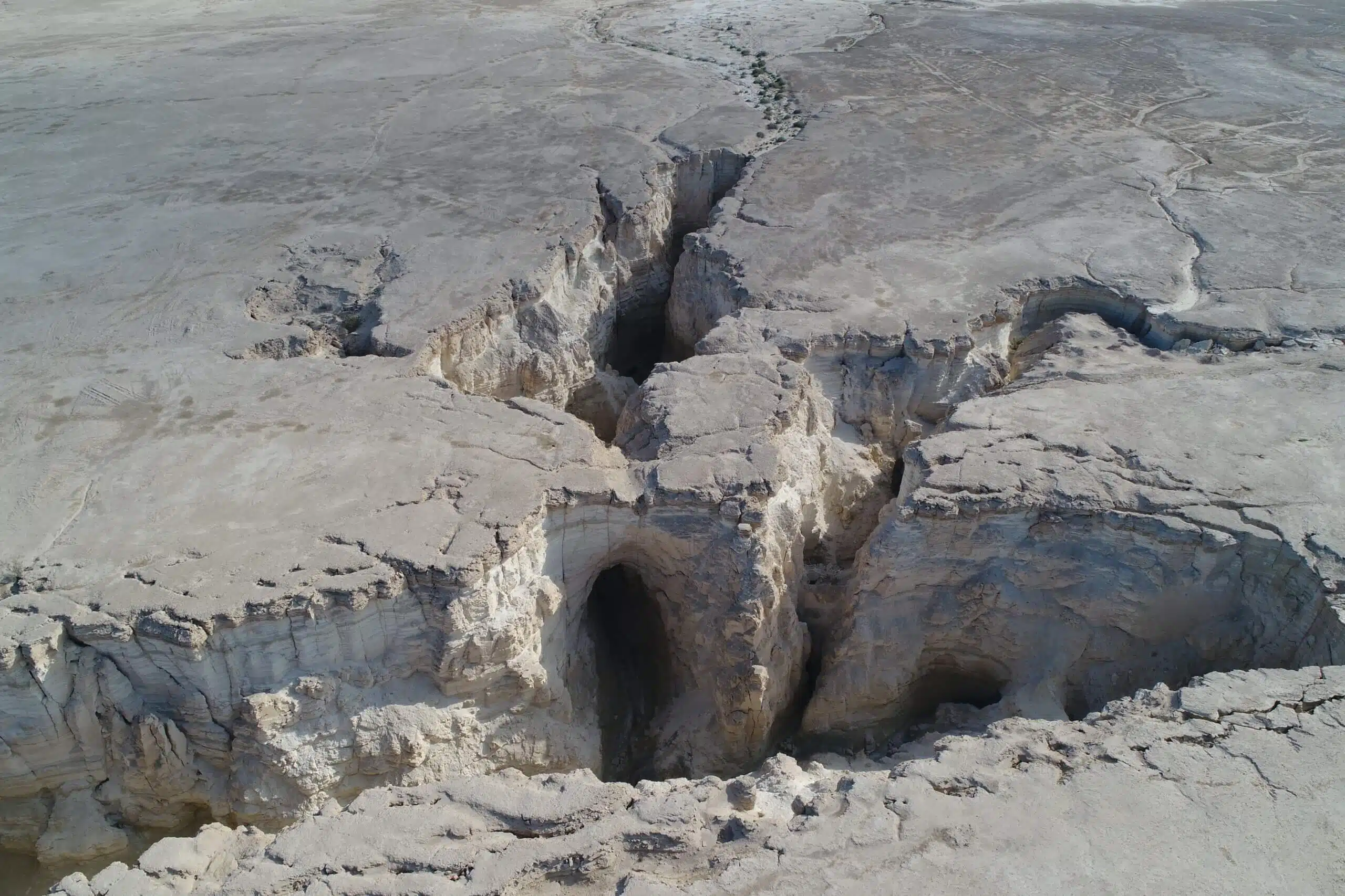
The analysis of the terrain route by the researchers indicated a unique drainage pattern of the stream, called 'rectangular'. This shape is characterized by 90-degree angles at the intersections of the canyon tributaries and at the turns of the canyons. The researchers found that each of the tributaries of the canyon begins with a high waterfall of about 20-30 meters, but the amount of water that is expected to drain into each of the waterfalls during the rare rain events is unusually small and cannot explain the formation of the waterfall. In addition, the researchers mapped systems of sinkholes in the Amiaz plain, as well as many caves that connect the sinkholes with the canyons of Nahal Perzim. The most famous of them is the flour cave that was closed to travelers in the early 2000s.
The research findings indicate that cracks created about 10,000 years ago following earthquakes help the rare rainwater to seep into the subsoil. The flow of water along the cracks washed away the soft surrounding rocks and created the caves. The collapse of the roof of these caves created sinkholes that differ in the process of their formation from the famous sinkholes on the shores of the Dead Sea that were created due to the mass in the subsoil. When the entire roof of the cave collapsed, a new tributary of the stream was created. Cracks exposed in the bank of the new tributary allow the Nahal Perzim canyon system to continue to expand. The cracks that were originally perpendicular to each other dominate the rectangular drainage pattern. The study's conclusions stand in contrast to the classical model which states that the process of deepening the stream channel and canyons includes flow on the surface and gradual lowering of the stream bed.
"Our research combines an analysis of the unique landscape forms in the Amiaz Plain area and a field experiment and offers a fascinating model for the development of Nahal Paretzim in its current form. We also found that the system of caves and sinkholes of Mishor Amiaz is still active. We anticipate that existing sinkholes will expand and new sinkholes will be created. This is a geological risk that must be taken into account," concluded Prof. Liran Goren who led the research.
The study is based on the master's thesis of Matanya Hamoi under the guidance of Prof. Liran Goren, Dr. Amit Moshkin, and Dr. Tzafrir Levy.
This research (No. 562/19) was supported by the National Science Foundation and the Israel Geological Survey.
More of the topic in Hayadan:
