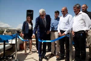
Last week the EGNOS station - (European Geostationary Navigation Overly Service) - a ground station of the European navigation system was launched at the Technion in the capacity of the head of the EU delegation in Israel, Ambassador Lars Faborg Andersen. The establishment of the station is the result of a collaboration between the European Space Agency, the Mapping and Geo-Information Engineering Track at the Faculty of Civil and Environmental Engineering at the Technion and the Melam plant of the Aerospace Industry. The project was brought to Israel thanks to the efforts of ISERD - the Israeli administration for European R&D operating from the Innovation Authority (formerly the Office of the Chief Scientist), which also accompanied the establishment together with the European project EGNIS managed by ISERD and the Israel Space Agency.
The system, which will be open to anyone who has a dedicated GPS receiver, has many applications: navigation of air, sea and land transport, guidance systems, mapping systems, navigation applications of all kinds, etc. Dr. Israel Kashani, from the Melam plant in the Aerospace Industry, said that "the station at the Technion will improve the level of accuracy in GPS receivers all over the State of Israel and its surroundings. The station has been fully operational since the beginning of 2016 and will be operational at the beginning of 2017."
The EU Ambassador to the State of Israel, Lars Faborg-Andersen, said that "Israel has a significant role in the development of the European Union's Galileo satellite navigation system. The inauguration of the satellite ground station in Israel is another example of the close cooperation between us."
The director general of the Directorate for Research for European Development, Neely Shalu, stated that "the establishment of the station is another achievement in the technological cooperation with Europe in general and especially in the field of space". She added that "thanks to the close cooperation between all the bodies involved, the quality of the data will improve significantly for all target audiences, including public, academic, industrial bodies and even private individuals."
The senior deputy to the president of the Technion, Prof. Moshe Sidi, said that "in recent years, the Technion strives to create international collaborations in research. That is why it is no wonder, and no coincidence, that the Technion was chosen to host the first Agnus station in Israel."

Prof. Gilad Ibn-Zur, a faculty member in the Faculty of Civil and Environmental Engineering, is in charge of the station located in the Rabin Building at the Technion. According to him, "those who use the GPS receiver on their mobile phone can today get a position with an accuracy of about ten meters. Such a level of accuracy obviously helps to navigate a car on the road for example, but sometimes it is not sufficient. EGNOS will provide much higher accuracy in determining a position - order of magnitude of one meter. I, as a researcher who uses sophisticated GPS receivers, can also reach a relative accuracy of a few millimeters - a need that is very critical in tracking the movements of the earth."
EGNOS consists of three geostationary satellites - that is, satellites located above fixed points on Earth - and a network of ground reference stations (RIMS). EGNOS satellites transmit signals that allow users to receive a location throughout Europe and its surroundings (including Israel) in real time with an accuracy of about one meter. The system expands the American GPS system and so far 43 such stations have been deployed around the world, of which 3 are in the Middle East: Turkey, Egypt and now Israel.
The information provided by the EGNOS system is used, free of charge, by all GPS receivers and provides accuracy, completeness, continuity and availability. The information obtained is added to the data coming from satellite systems such as GPS (the American navigation satellites), GLONASS (the Russian navigation satellites) and in the future Galileo - the European navigation satellite system, which will include 30 satellites and improve the navigation capability and location data in Europe and the entire world.

One response
Greetings
I am interested in a GPS with an accuracy of up to 11 meters for use in private vehicles
For the purpose of implementing an application in a mobile application that I developed
I would love to receive a name and phone number to inquire about details
Thanks
Abi Solomon
054-5276812
Hello my father, a message like this belongs on a Facebook page. Not in the comments mechanism of an article